Downloading TZ Maps
After subscribing to a TZ Maps area, you will be able to stream the chart directly to your device over the Internet as you pan and zoom the screen (Wi-Fi or Cellular Connection required). However, before using TZ iBoat on the water, it is highly recommended to store the chart locally on your device so that you can access them without any Internet connection at sea.
Offline Chart Screen
To store the chart on your device, click on the “TZ” button located on the top left of your screen and select “Offline Charts & Weather”. Tap on "Offline TZ MAPS" to open the screen that will allow you to download TZ Maps.
Important: If you purchased a chart area before June 21st 2023 make sure to select "MM3D Offline Charts". Please refer to Downloading Charts (legacy MM3D Charts) for more information.
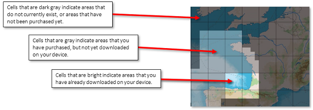
Tapping Offline TZ Maps brings up the TZ Maps download window, which shows you the TZ Maps areas available on your device. In the screenshot below:
- Hatched cells indicate areas that do not currently exist or have not yet subscribed.
- Gray hatched indicate areas you have suscribed but not yet downloaded to your device.
- Green cells indicate areas that you have downloaded to your device.
- Green hatched cells indicate that you have downloaded areas to your device for a previous subscription, but have not yet renewed it. In this case you must renew your subscription to get the latest upgrades.

Note that the cell coverage will automatically adjust in size as you zoom in or zoom out on the chart to make larger or smaller selection easier.
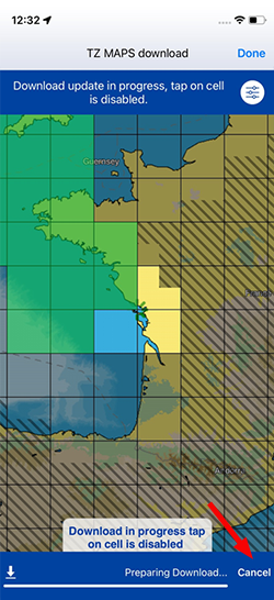
To download chart data, just tap once on one or multiple cells. As soon as you start taping on these cells, a progress bar will be displayed at the bottom with the size and the remaining time. It is recommended to leave TZ iBoat on the download screen while downloading data, however, if you close this screen the download will continue in the background (albeit slower).
Important: You will need at least 1GB of free space on your device to be able to download charts.
Note that by default, for each cell you tap, TZ iBoat will download vector data and HR bathymetric data (the HR Bathy is used to create BathyVision charts and Depth Shading overlay). If you would like to download Raster charts (in addition to Vector charts), you can tap on the settings button located in the upper right-hand corner:

Note: If you uncheck a data type that you have already downloaded, TZ iBoat will delete this data type to free up space on your device. A confirmation window will be presented on your screen for validation.
Note: It is not possible to download Satellites Photos from this screen. You need to have an Internet connection to stream Satellite Photos. However, Satellite Photos that have been previously streamed will stay on your device and can be displayed offline.
To delete chart data that was previously downloaded and free up space on your device, tap twice (1 & 2) on a green cell:

Note: If you want to delete all charts previously downloaded on your device, you can tap on the settings button located in the upper right-hand corner and select "Delete All"
TZ Maps Update
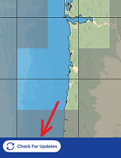
The TZ Maps are updated continuously. To check for update, simply tap on the button "Check for Updates" that will appear at the bottom of the Offline Chart screen (the update button will only appear if cells were previously downloaded):

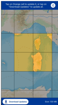
When TZ Maps updates are available on the server, a download icon will appear above each updated cell, as shown in the following picture. Simply tap "Download Updates" to begin the update process:


Note that you can cancel the current download by clicking Cancel. You can then return to this screen later to resume the download.